Digital Map (large file) PDF Format
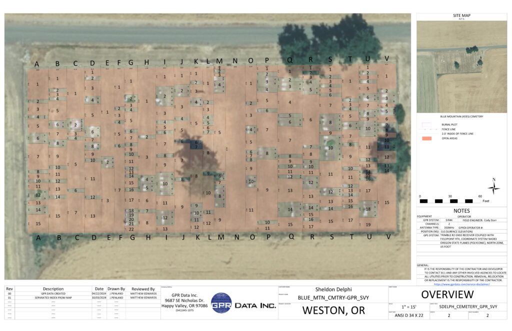
The digital map was created from Ground Penetrating Radar (GPR) technology. Funds were furnished through grants from the Historic Cemetery Grant Program and AWERE. The GPR was used to identify graves that were not designated by a gravestone or other identifiable marker. It also provided information where there is no burial at that location.
Index to Digital Map PDF Format
The Index is by Columns and Rows. It is not alphabetical. For an alphabetical index go to the Burials page. That index includes DOB and DOD in most cases. It is not a complete index of the cemetery which is why the GPR technology was used to determine burials at the cemetery.